Walking a bit of the "Stop Line Way".
02nd January 2023
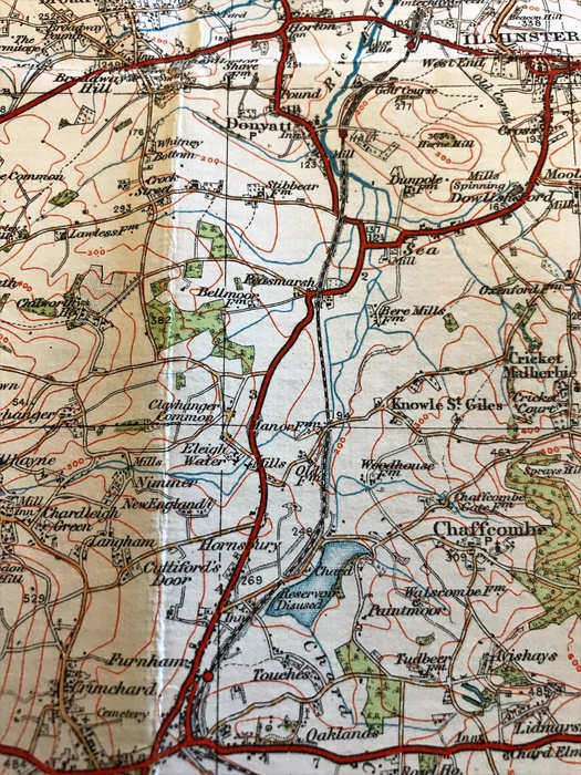
An excerpt from a pre-war copy of a Chard and Axminster OS map showing the GWR branch line as it was. The walk today was between the road bridge on the lane to Chaffcombe (near the reservoir), and Peasmarsh. At Peasmarsh the A358 has since been diverted along the old p-way for a short distance (you can clearly see the obvious route the road would take), meaning that a slight diversion is required by the walker before re-joining the route along the old line towards Donyatt and Ilminster.
Opened in 1866, the Bristol & Exeter Railway's line between Creech Junction and Chard ran for about 15.5 miles through rural Somerset, built in-part over the route of the Chard Canal, one of the last canals to be built in England. A short, separate, branch from the L&SWR mainline at Chard Junction to Chard had already opened in 1863. The B&ER line was absorbed by the GWR in 1876, and having been originally built to broad gauge was converted to the more universal "narrow gauge" in 1891. For almost 100 years the line quietly existed, serving the rural community and providing a useful link to the county town of Taunton for those living in south Somerset. Businesses in Chard were also able to make use of the line for the movement of their goods. But a line such as this was never going to be able to balance the books for the "modern" age and even before Dr. Beeching had a chance to do his "thing" the passenger service had been withdrawn in 1962. Goods traffic lasted a little longer though, as it often did during the sixties, bowing out in 1964 between Chard and Creech, and 1966 between Chard and Chard Junction.
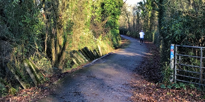
Looking north at Chaffcombe Lane, with concrete tank traps still standing along the route here, on the left.
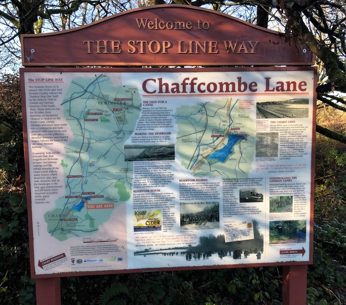
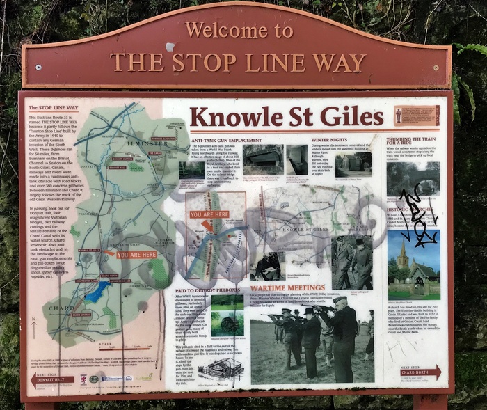
Interestingly the railway from Chard to Creech was identified as part of a south-to-north line of defence should the Germans' invade England during WWII and as such was given additional defensive positions and obstacles designed to hamper any enemy advances.
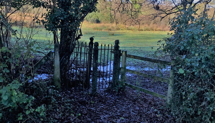
A cast iron former-GWR kissing gate at Chaffcombe Lane.
One of a number of similar lines of defence in Britain, this one stretched for 50 miles between Seaton on the south coast to Highbridge in the north, and en-route used the rivers, railways and canal routes along the way. Concrete gun emplacements and "dragon's teeth" blocks, as well as other various structures designed with defence and obstruction in mind, were built along the route of the Stop Line and many remain in-situ today, reminding us of our recent past history.
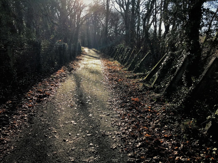
More tank traps near Knowle St. Giles, looking south.
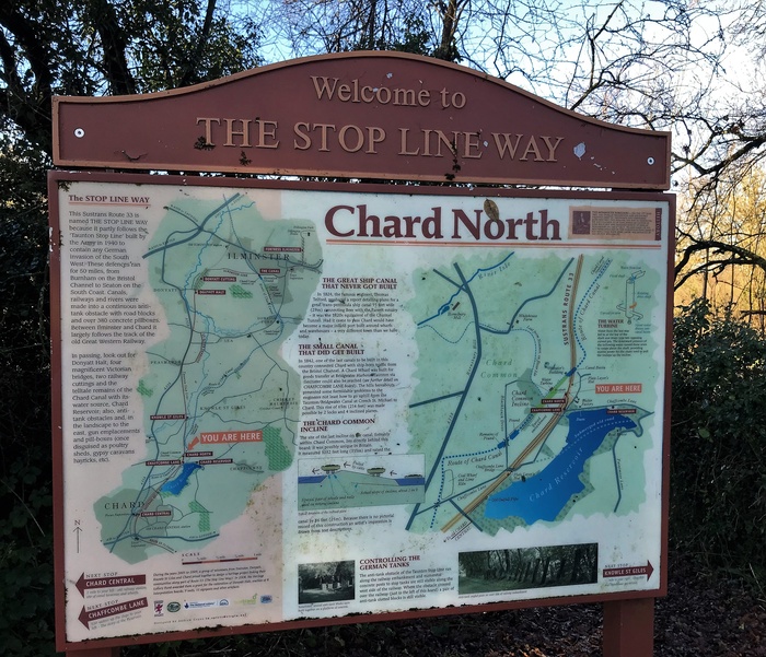
These structures feature prominently today along what is now known as the "Stop Line Way", a section of the Sustrans Route 33 cycle and walking route that can be accessed between Chard and Ilminster over much of the old branch line.
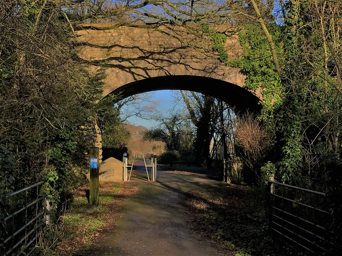
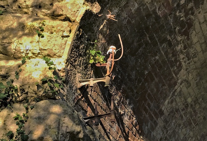
The warm ham stone of the road bridge at Knowle St. Giles glows in the low winter sun. Those brackets on the bridge have not carried telegraph wires for nearly 60 years, but remarkably still remain!
Bank holiday Monday 2nd January 2023 was a bright and fresh day, ideal for a walk with the dogs, so after a short drive to Chaffcombe Lane we were able to access the railway for a gentle and pleasant walk towards Peasmarsh and back.
Although the whole route between Chard and Ilminster is owned by South Somerset County Council, the section between Chard and Peasmarsh is actually leased by Sustrans (until 2028), and they have clearly invested quite a bit on this section, with tarmac laid along the path and the verges neatly manicured. This contrasts starkly with the other section from Peasmarsh to Ilminster, which although reasonably maintained it is nowhere near as pristine, and obviously less cared-for. But nevertheless the whole route cuts a lovely path through some pretty countryside and is well-used by the locals, whether cyclist, jogger or indeed dog walker!
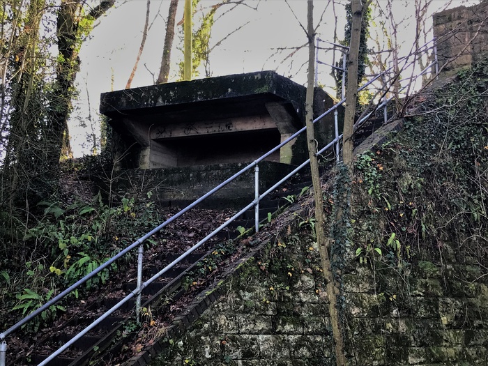
The gun emplacement at Knowle St. Giles bridge has been preserved as a reminder of our recent past.
On this day we walked from Chaffcombe to Peasmarsh and return, but have often walked from Peasmarsh to Ilminster and back, but have yet to tackle the whole Chard to Ilminster and back in one go - that'll be for a summer's day outing I think!
Here are a selection of the information boards that can be found along the route:
Opened in 1866, the Bristol & Exeter Railway's line between Creech Junction and Chard ran for about 15.5 miles through rural Somerset, built in-part over the route of the Chard Canal, one of the last canals to be built in England. A short, separate, branch from the L&SWR mainline at Chard Junction to Chard had already opened in 1863. The B&ER line was absorbed by the GWR in 1876, and having been originally built to broad gauge was converted to the more universal "narrow gauge" in 1891. For almost 100 years the line quietly existed, serving the rural community and providing a useful link to the county town of Taunton for those living in south Somerset. Businesses in Chard were also able to make use of the line for the movement of their goods. But a line such as this was never going to be able to balance the books for the "modern" age and even before Dr. Beeching had a chance to do his "thing" the passenger service had been withdrawn in 1962. Goods traffic lasted a little longer though, as it often did during the sixties, bowing out in 1964 between Chard and Creech, and 1966 between Chard and Chard Junction.
Looking north at Chaffcombe Lane, with concrete tank traps still standing along the route here, on the left.
Interestingly the railway from Chard to Creech was identified as part of a south-to-north line of defence should the Germans' invade England during WWII and as such was given additional defensive positions and obstacles designed to hamper any enemy advances.
A cast iron former-GWR kissing gate at Chaffcombe Lane.
One of a number of similar lines of defence in Britain, this one stretched for 50 miles between Seaton on the south coast to Highbridge in the north, and en-route used the rivers, railways and canal routes along the way. Concrete gun emplacements and "dragon's teeth" blocks, as well as other various structures designed with defence and obstruction in mind, were built along the route of the Stop Line and many remain in-situ today, reminding us of our recent past history.
More tank traps near Knowle St. Giles, looking south.
These structures feature prominently today along what is now known as the "Stop Line Way", a section of the Sustrans Route 33 cycle and walking route that can be accessed between Chard and Ilminster over much of the old branch line.
The warm ham stone of the road bridge at Knowle St. Giles glows in the low winter sun. Those brackets on the bridge have not carried telegraph wires for nearly 60 years, but remarkably still remain!
Bank holiday Monday 2nd January 2023 was a bright and fresh day, ideal for a walk with the dogs, so after a short drive to Chaffcombe Lane we were able to access the railway for a gentle and pleasant walk towards Peasmarsh and back.
Although the whole route between Chard and Ilminster is owned by South Somerset County Council, the section between Chard and Peasmarsh is actually leased by Sustrans (until 2028), and they have clearly invested quite a bit on this section, with tarmac laid along the path and the verges neatly manicured. This contrasts starkly with the other section from Peasmarsh to Ilminster, which although reasonably maintained it is nowhere near as pristine, and obviously less cared-for. But nevertheless the whole route cuts a lovely path through some pretty countryside and is well-used by the locals, whether cyclist, jogger or indeed dog walker!
The gun emplacement at Knowle St. Giles bridge has been preserved as a reminder of our recent past.
On this day we walked from Chaffcombe to Peasmarsh and return, but have often walked from Peasmarsh to Ilminster and back, but have yet to tackle the whole Chard to Ilminster and back in one go - that'll be for a summer's day outing I think!
Here are a selection of the information boards that can be found along the route: